
Tellus: Atlas and Wildlife
A Tellus addon connecting real-world coordinates to geographic wildlife distributions, country discovery HUDs, and an exploration journal.
Overview
Designed for NeoForge 1.21.1, Tellus: Atlas & Wildlife (TAW) expands the base Tellus mod by tying real-world geography to animal habitats, travel tracking, and settlements. By utilizing the latitude and longitude coordinates from Tellus, it adjusts where creatures appear and tracks player movement across the planet. It also provides options for populating generated cities or placing village clusters near real-world urban coordinates.
Running the project requires Minecraft 1.21.1, NeoForge 21.1.238 or newer, and Tellus 0.8.1 or newer, and it must be present on both the client and server for full functionality. The interface automatically adapts to the player's selected language, supporting English alongside Spanish variants for Spain, Mexico, Argentina, Chile, Ecuador, Uruguay, and Venezuela. All geographic distributions and urban tiers are curated approximations made for gameplay rather than exact scientific or demographic records.
Geographic Wildlife and Exploration
Animal spawning and fishing outcomes are filtered and assisted based on real-world coordinates without completely replacing default spawning mechanics. The system enforces local population caps to prevent overpopulation and helps terrestrial, freshwater, and amphibious creatures appear where standard Minecraft biomes do not accurately reflect the real location. Players can check regional species using the `/taw localfauna` command, earn advancements and XP for finding animals, and view approximate distribution maps for discovered fauna.
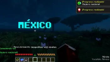
As players travel, a location HUD displays the current locality, region, and country while recording discoveries in an Exploration Journal. Entering new countries triggers on-screen titles, and players can uncover natural wonders while building persistent progress from local areas up to entire continents. Server operators also have access to administration commands to adjust or reset a player's wildlife and geographic records.
Urban Centers and City Population
Depending on which Tellus world-generation layers are active, the mod can either generate settlement clusters or populate existing city structures. When Tellus Buildings are turned off, TAW places Minecraft-styled settlements near real-world urban locations, scaling from 1 settlement for a Regional center up to 7 settlements for a Megalopolis, alongside 2 for Major, 3 for Metropolis, and 5 for Megacity tiers. This catalog covers the entire globe with a focus on Latin America, Mexico, Europe, and Japan, and automatically clears trees so roads and buildings are not obstructed.
When both Tellus Roads and Buildings are enabled, the mod disables settlement clusters and instead spawns residents based on the beds detected in new city chunks. Administrators can choose to spawn villagers, zombies, or no residents at all, adjust population density between 10% and 100% per bed, and set per-chunk limits for inhabitants and Iron Golems. There is also a zombie-apocalypse setting that replaces all villagers with zombies and prevents Iron Golems from spawning.
Mod Integrations and Technical Design
TAW supports optional integrations with several wildlife and structure mods to expand its geographic systems. Compatible fauna mods include Naturalist, Hybrid Aquatic, Aquaculture 2, Critters and Companions, and a 1.21.1-compatible port of Alex's Mobs, alongside selected vanilla animals. For urban areas, it optionally integrates with Luki's Grand Capitals for capital structures and Waystones to assign real-world place names to newly generated waystones.
To keep server performance stable, background tasks are spread across different ticks and external network queries run outside the main server thread. The mod translates coordinates into place names via OpenStreetMap's Nominatim service, which exposes the server IP and coordinates but never sends player UUIDs, usernames, or gameplay analytics. Additionally, an expanded urban catalog can download the GeoNames `cities1000` dataset once to create a local cache, falling back to a bundled offline catalog if the connection fails.
How to install
- Install the loader shown in the table (Fabric, Forge or NeoForge) for the same Minecraft version.
- Put the .jar file into
.minecraft/mods. - Start Minecraft with that loader profile.
Similar

An addon for Terra++ that renders real-world OpenStreetMap maps, minimaps, coordinates, and worldwide teleportation inside Minecraft for Build The Earth.
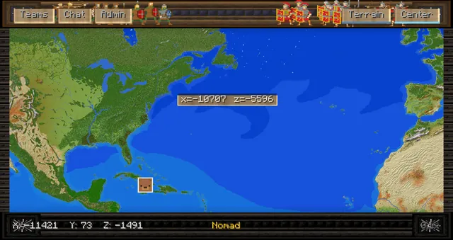
An interactive political and terrain world map mod for the Rise of the Ottomans nations server with territory claiming, alliances, wars, and waypoints.

A dynamic real-world map mod designed for use with the Terra++ Earth terrain generator.

A Spigot plugin that wraps world borders horizontally to simulate a cylindrical globe for Earth map servers.
 1:326
A server-side mod that teleports entities across world borders to simulate spherical wrapping on 1:326 and other Earth maps.
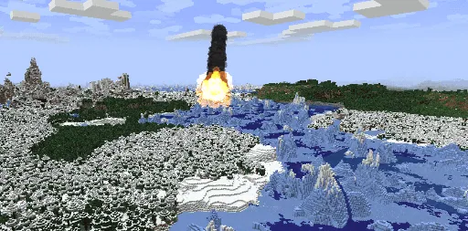
A server mod designed to populate pre-generated real-world Arnis maps with modded ores and resources via meteor impacts.