
Voxel Earth
A plugin and pipeline that converts and streams Google Photorealistic 3D Tiles into Minecraft as voxelized real-world chunks.
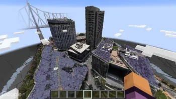
Overview
Voxel Earth is a complete pipeline created by ryanhlewis that transforms photogrammetry and 3D Tiles into block-based worlds for Minecraft Java Edition. By pulling data from sources like Google Photorealistic 3D Tiles, the system normalizes real-world geometry and translates it into standard Minecraft block palettes. This on-demand streaming mechanism lets players explore actual cities, landmarks, and mountain ranges as voxelized chunks generate around them while they move.
The ecosystem combines a server plugin, standalone command-line tools, and a browser-based web viewer. Each core stage of the conversion workflow—downloading, Draco decoding, and voxelizing—is built directly into the plugin while also functioning as an independent CLI utility for local testing. Furthermore, the web client offers a way to retrieve, rotate, and inspect tilesets or adjust parameters inside a web browser prior to setting up a server.
Server Requirements and Technical Design
The plugin prioritizes server performance by relying on CPU-based voxelization instead of demanding a dedicated graphics card. It is distributed as a single shaded JAR file that integrates with FastAsyncWorldEdit (FAWE) to execute asynchronous block placement rapidly. Because geometry is retrieved and converted dynamically as players travel across the map, terrain is built on the fly.
Operating the Voxel Earth plugin requires a Paper or Spigot server running version 1.20 or higher, paired with Java 21+ and FastAsyncWorldEdit. Server administrators also need to provide a Google API key to activate geocoding functionality and 3D tile retrieval. All command permissions are organized under the voxelearth.* namespace and default to standard players or operators depending on the action.
In-Game Commands and Controls
Players can travel to real-world locations and customize how terrain generates through built-in geocoding and movement commands. The /visit command teleports a player to a searched city or landmark and starts streaming the surrounding area, whereas /moveload toggles automatic tile loading as the user walks. Players can adjust their personal settings with /visitradius, /moveradius, and /movethreshold to dictate the quantity of loaded tiles and the block distance needed to initiate new generation.
Server operators have access to administrative commands for saving API credentials and managing tile generation for other users. The /voxelapikey command saves the required Google API key for the server. Administrators can also execute /visitother to send another player to a geocoded destination, or modify other players' loading radii and movement thresholds via /visitradiusother, /moveradiusother, and /movethresholdother.
How to install
- Install the loader shown in the table (Fabric, Forge or NeoForge) for the same Minecraft version.
- Put the .jar file into
.minecraft/mods. - Start Minecraft with that loader profile.
Similar

A customizable world generation platform and API for Fabric, Forge, and Bukkit servers used to create custom and Earth-like terrain.
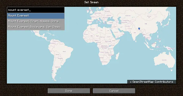 1:40m
A world generation mod that creates a customizable, scale-adjustable replica of planet Earth using streamed geographic data.
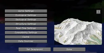
A world generation mod that streams real-world elevation, climate biomes, roads, and buildings from geographic and OpenStreetMap datasets.
A world generation mod that adds a real Earth world type to Minecraft.
 ~1:6
A configurable real-Earth world generator using AWS elevation tiles and climate data to create Earth terrain at adjustable zoom scales.
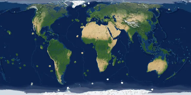
A real-Earth world generator for TerraFirmaCraft featuring real continents, rivers, lakes, mountains, climate zones, and coordinate spawning.
A China-optimized fork of the Tellus mod that generates real-world Earth terrain, elevation, biomes, and climate from geographic data.
 1 to 1
A performance-focused fork of the Terra 1 to 1 mod that generates the real Earth at a 1:1 scale using online datasets and OpenStreetMap.